Lancaster-Ease Gill Cave System

Aerial photographs

The Caves under and around Ease Gill on the Cumbria/Lancashire of border of the UK form the longest and most complex system in Britain. The system extends beneath Casterton, Leck and Ireby Fells around the western and southern flanks of Gregareth Hill. The caves are formed in the Carboniferous (Dinantian) Great Scar Limestone.They contain a wide range of passage types, sediments and speleothems. See page on Science

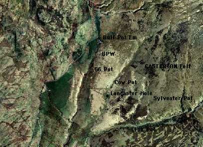
Aerial view of Casterton Fell in the area around Lancaster Hole. You can click on the labels on the map to go to various cave entrances and other locations.

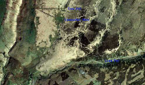
A larger scale aerial view of the area around Lancaster Hole. The path across the fell to the cave entrance can clearly be seen as a dark straight line in the top left of the photo.


If you would like to return to the Red Rose site at anytime just click on the Red Rose in the top left of the page
To E-Mail us CLICK HERE

R.R.C.P.C. 2002