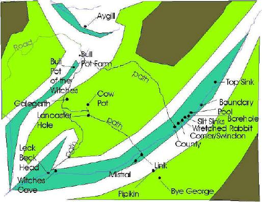
Location of the Caves of the Lancaster Ease Gill System
You can click on labels on this map to go to pages about that cave.
Scroll down to see aerial photo and
satellite image
below.
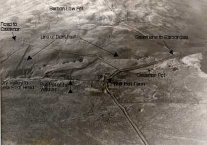
Part of Casterton Fell from the air.
This shot, looking West, was taken from a light aircraft over Casterton Fell
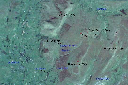
Satellite Image of the area around Casterton Fell
Back to Top
R.R.C.P.C. 2000